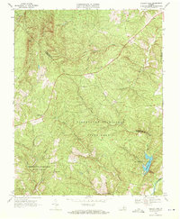
1968 Map of Holiday Lake
USGS Topo · Published 1972About this map
The Appomattox-Buckingham State Forest dominates this Central Virginia landscape, illustrating a late-1960s balance between preserved timberlands and rural community hubs. Small settlements like Toga, Sliders, and Hollywood serve as anchor points along the winding secondary roads that navigate the complex drainage systems of the Appomattox River. The terrain is characterized by a dense network of watercourses, including Fishpond Creek and North Holiday Creek, which converge near the Holiday Lake State Recreation Area.
Find a feature on this map
35 named features on this map. Tap any name to fly to it.
Don’t see what you’re looking for? This feature index may not catch every label — zoom into the map to look around manually.
Map Details
Editions of this 1968 Holiday Lake Map
3 editions found
Other maps of this area

1892 · Buckingham
USGS Topo · 1:125,000

1892 · Appomattox
USGS Topo · 1:125,000

1947 · Roanoke
USGS Topo · 1:250,000

1958 · Appomattox
USGS Topo · 1:62,500

1958 · Pamplin City
USGS Topo · 1:62,500

1959 · Roanoke
USGS Topo · 1:250,000

1961 · Shipman
USGS Topo · 1:62,500

1961 · Buckingham
USGS Topo · 1:62,500

1963 · Roanoke
USGS Topo · 1:250,000

1967 · Andersonville
USGS Topo · 1:24,000