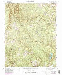
1968 Map of Holiday Lake
USGS Topo · Published 1982About this map
The Appomattox-Buckingham State Forest dominates this landscape, covering a significant portion of the border between Buckingham and Appomattox counties. This survey reflects the mid-century development of the region's recreational and forestry infrastructure, centered on Holiday Lake and its associated State Park. The terrain is characterized by a dense network of watercourses, including the Slate River and Fishpond Creek, which carve through the Piedmont hills. Small, localized settlements such as Toga, Sliders, and Jamison are connected by a web of rural roads, often punctuated by historical landmarks like Union Ch and Bethlehem Ch. The presence of scattered Cem labels throughout the forest and near Hollywood provides vital clues for genealogists researching families from this heavily wooded interior. This map also tracks 1970s updates in purple, showing road modifications and buildings added after the original field check.
Find a feature on this map
28 named features on this map. Tap any name to fly to it.
Don’t see what you’re looking for? This feature index may not catch every label — zoom into the map to look around manually.
Map Details
Editions of this 1968 Holiday Lake Map
3 editions found
Other maps of this area

1892 · Buckingham
USGS Topo · 1:125,000

1892 · Appomattox
USGS Topo · 1:125,000

1947 · Roanoke
USGS Topo · 1:250,000

1958 · Appomattox
USGS Topo · 1:62,500

1958 · Pamplin City
USGS Topo · 1:62,500

1959 · Roanoke
USGS Topo · 1:250,000

1961 · Shipman
USGS Topo · 1:62,500

1961 · Buckingham
USGS Topo · 1:62,500

1963 · Roanoke
USGS Topo · 1:250,000

1967 · Andersonville
USGS Topo · 1:24,000