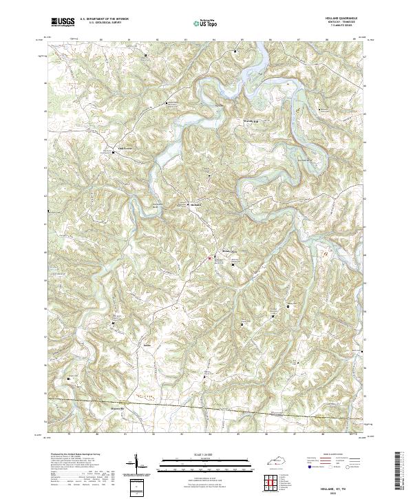
2022 Map of Holland
USGS Topo · Published 2022About this map
Holland and surrounding rural communities along the Barren River sit at the southern edge of Kentucky, where the landscape is defined by the sharp bends of the river and a dense network of local creeks. The terrain features distinctive hydrological and topographical markers such as The Sink, Jewsharp Bend, and Horseshoe Bend. This area shows a pattern of settlement closely tied to these waterways and ridge roads like Pitchford Ridge Rd and Brown Ridge Rd. Genealogists and local historians can find a high density of small family and community burial sites, including the Benedict Graveyard, Tracy Family Cem, and the uniquely named Federal Government Cem. From the small hub at Mount Zion to the southern edge of Hayesville near the Allen Co Macon Co line, the map documents a traditional agricultural region with deep roots in its small Baptist and Mennonite congregations.
Find a feature on this map
100 named features on this map. Tap any name to fly to it.
Don’t see what you’re looking for? This feature index may not catch every label — zoom into the map to look around manually.
Map Details
Editions of this 2022 Holland Map
This is the sole edition of this map. No revisions or reprints were ever made.
Other maps of this area

1926 · Scottsville
USGS Topo · 1:62,500

1931 · Lafayette
USGS Topo · 1:62,500

1931 · Red Boiling Springs
USGS Topo · 1:62,500

1953 · Tracy
USGS Topo · 1:24,000

1954 · Austin
USGS Topo · 1:24,000

1954 · Fountain Run
USGS Topo · 1:24,000

1954 · Petroleum
USGS Topo · 1:24,000

1954 · Scottsville
USGS Topo · 1:24,000

1954 · Holland
USGS Topo · 1:24,000

1956 · Corbin
USGS Topo · 1:250,000