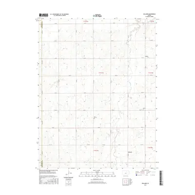
2015 Map of Holland
USGS Topo · Published 2015About this map
Holland and Acme anchor this section of the Kansas plains, situated along the county line between Saline County and Dickinson County. The landscape is defined by the wandering path of Holland Creek, which carves a drainage pattern through the township sections. This 2015 survey reveals a remarkably consistent grid of agricultural access roads, with east-west thoroughfares like 1800 Ave and 1400 Ave spaced precisely one mile apart. This rigid surveying system, established by the Public Land Survey System, dictates the layout of modern rural life in the region. Local history and genealogy researchers can identify specific burial grounds such as Green Lawn Cemetery and Harmony Cemetery, which serve as permanent landmarks amidst the shifting seasonal crops of the surrounding farmland.
Find a feature on this map
29 named features on this map. Tap any name to fly to it.
Don’t see what you’re looking for? This feature index may not catch every label — zoom into the map to look around manually.
Map Details
Editions of this 2015 Holland Map
This is the sole edition of this map. No revisions or reprints were ever made.
Other maps of this area

1889 · Abilene
USGS Topo · 1:125,000

1894 · Abilene
USGS Topo · 1:125,000

1955 · Niles
USGS Topo · 1:24,000

1955 · Kipp
USGS Topo · 1:24,000

1955 · Gypsum
USGS Topo · 1:24,000

1955 · Hutchinson
USGS Topo · 1:250,000

1959 · Hutchinson
USGS Topo · 1:250,000

1963 · Abilene SW
USGS Topo · 1:24,000
1963 · Holland
USGS Topo · 1:24,000
1963 · Solomon
USGS Topo · 1:24,000