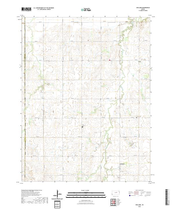
2022 Map of Holland
USGS Topo · Published 2022About this map
Holland and Acme anchor this rural section of Dickinson County, characterized by its precise grid of section lines and the winding path of Holland Creek. The landscape is a classic example of the American Rectilinear Survey system, where the township and range lines of t14s r1e and its neighbors define the placement of arterial roads like 1900 Ave and Solomon Rd. This geometric layout is punctuated by small, local landmarks essential to genealogical research, such as Green Lawn Cem and Harmony Cem. These sites, along with the scattered farmsteads served by named routes like Daisy Rd and Fair Rd, reflect a settled agricultural community that has maintained its spatial organization for over a century. The boundary with Saline County runs along the western edge, marking the transition between these two Central Kansas jurisdictions.
Find a feature on this map
32 named features on this map. Tap any name to fly to it.
Don’t see what you’re looking for? This feature index may not catch every label — zoom into the map to look around manually.
Map Details
Editions of this 2022 Holland Map
This is the sole edition of this map. No revisions or reprints were ever made.
Other maps of this area

1889 · Abilene
USGS Topo · 1:125,000

1894 · Abilene
USGS Topo · 1:125,000

1955 · Niles
USGS Topo · 1:24,000

1955 · Kipp
USGS Topo · 1:24,000

1955 · Gypsum
USGS Topo · 1:24,000

1955 · Hutchinson
USGS Topo · 1:250,000

1959 · Hutchinson
USGS Topo · 1:250,000

1963 · Abilene SW
USGS Topo · 1:24,000
1963 · Holland
USGS Topo · 1:24,000
1963 · Solomon
USGS Topo · 1:24,000