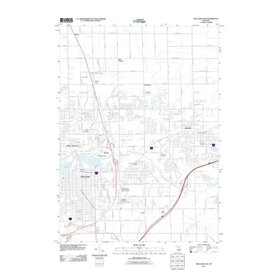
2011 Map of Holland East
USGS Topo · Published 2011About this map
The Macatawa River and its branches define the eastern landscape of the Holland-Zeeland corridor, winding through a region where agricultural heritage meets academic and suburban expansion. Cultural landmarks like Windmill Island and the Veldheers Tulip Gardens underscore the area's Dutch heritage, while the presence of the Overisel Oil Field indicates the subsurface industrial resources of the county. Smaller historic settlements like Noordeloos, Harlem, and New Holland remain distinct from the larger centers of Holland and Zeeland. Local history researchers can find numerous burial sites across the landscape, including Noordeloos Cemetery, New Groningen Cemetery, and Roselawn Memorial Gardens. The map also documents the educational footprint of the region, specifically Grand Valley State University- Meijer Campus and the Davenport University- Holland Campus.
Find a feature on this map
74 named features on this map. Tap any name to fly to it.
Don’t see what you’re looking for? This feature index may not catch every label — zoom into the map to look around manually.
Map Details
Editions of this 2011 Holland East Map
This is the sole edition of this map. No revisions or reprints were ever made.
Other maps of this area

1928 · Fennville
USGS Topo · 1:62,500

1929 · Holland
USGS Topo · 1:62,500

1931 · Fennville
USGS Topo · 1:62,500

1932 · Holland
USGS Topo · 1:62,500

1958 · Allendale
USGS Topo · 1:24,000

1958 · Allegan
USGS Topo · 1:62,500

1958 · Grandville
USGS Topo · 1:62,500

1958 · Racine
USGS Topo · 1:250,000

1958 · Grand Rapids
USGS Topo · 1:250,000

1961 · Grand Rapids
USGS Topo · 1:250,000