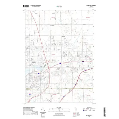
2019 Map of Holland East
USGS Topo · Published 2019About this map
Holland and the surrounding Dutch-heritage settlements of West Michigan occupy a landscape defined by the Macatawa River and its varied drainage networks. The city’s core is anchored by institutional landmarks such as Hope College and the Western Theological Seminary, while its cultural identity is signaled by Windmill Island just north of the downtown district. The transition from the urban grid of Holland into the more spread-out town of Zeeland to the east reveals a dense cluster of burial grounds, including Pilgrim Home Cem and Roselawn Memorial Gardens, which serve as vital touchstones for family historians. Smaller, traditionally established communities like Noordeloos and New Holland dot the northern reaches of the quadrangle, connected by a rigid system of section-line roads like Quincy St and New Holland St that cuts across the winding paths of the Bosch and Hulst Drain and Northwest of Zeeland Drain.
Find a feature on this map
51 named features on this map. Tap any name to fly to it.
Don’t see what you’re looking for? This feature index may not catch every label — zoom into the map to look around manually.
Map Details
Editions of this 2019 Holland East Map
This is the sole edition of this map. No revisions or reprints were ever made.
Other maps of this area

1928 · Fennville
USGS Topo · 1:62,500

1929 · Holland
USGS Topo · 1:62,500

1931 · Fennville
USGS Topo · 1:62,500

1932 · Holland
USGS Topo · 1:62,500

1958 · Allendale
USGS Topo · 1:24,000

1958 · Allegan
USGS Topo · 1:62,500

1958 · Grandville
USGS Topo · 1:62,500

1958 · Racine
USGS Topo · 1:250,000

1958 · Grand Rapids
USGS Topo · 1:250,000

1961 · Grand Rapids
USGS Topo · 1:250,000