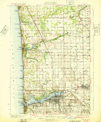
1932 Map of Holland
USGS Topo · Published 1932About this map
Black Lake and the industrializing shoreline of Lake Michigan anchor this early 1930s survey of Ottawa County. The city of Holland is depicted in detail, showing a dense street grid expanding toward Waverly and the waterfront. Along the southern shore of the lake, a string of resort communities and parks such as Macatawa, Virginia Park, and Central Park reflect the era's growing recreational economy. The Pere Marquette Railroad and the Pere Marquette Highway slice through the landscape, connecting these lakefront hubs to inland settlements like Zeeland and New Groningen.
Find a feature on this map
104 named features on this map. Tap any name to fly to it.
Don’t see what you’re looking for? This feature index may not catch every label — zoom into the map to look around manually.
Map Details
Editions of this 1932 Holland Map
2 editions found
Other maps of this area

1928 · Fennville
USGS Topo · 1:62,500

1929 · Holland
USGS Topo · 1:62,500

1930 · Lake Harbor
USGS Topo · 1:48,000

1930 · Muskegon
USGS Topo · 1:62,500

1931 · Fennville
USGS Topo · 1:62,500

1932 · Holland
USGS Topo · 1:62,500

1936 · Muskegon
USGS Topo · 1:62,500

1936 · Lake Harbor
USGS Topo · 1:62,500

1945 · Ravenna
USGS Topo · 1:62,500

1954 · Milwaukee
USGS Topo · 1:250,000