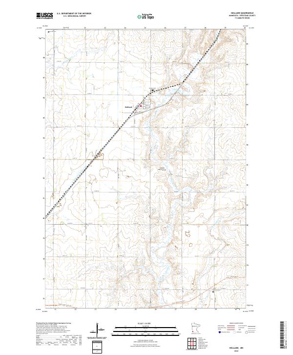
2022 Map of Holland
USGS Topo · Published 2022About this map
Holland sits atop the dramatic Coteau des Prairies upland, a prominent plateau that defines the local drainage patterns of Pipestone County. The settlement's grid is oriented around the former railroad corridor, now occupied by the Casey Jones State Trl as it cuts diagonally across the township lines. This landscape is a patchwork of agricultural sections drained by the Rock River and its various tributaries, including the N Br Pipestone Cr and the E Br Rock River. Genealogists and local historians can pinpoint significant sites like the Holland Cem located just northeast of the village and the Luctor Cem in the northwestern corner of the quadrangle. The map also documents the engineered water management systems of the region, such as County Ditch Number One, which assists the natural river networks in moving water off the plateau.
Find a feature on this map
45 named features on this map. Tap any name to fly to it.
Don’t see what you’re looking for? This feature index may not catch every label — zoom into the map to look around manually.
Map Details
Editions of this 2022 Holland Map
This is the sole edition of this map. No revisions or reprints were ever made.
Other maps of this area

1953 · Watertown
USGS Topo · 1:250,000

1955 · Sioux Falls
USGS Topo · 1:250,000

1958 · Sioux Falls
USGS Topo · 1:250,000

1958 · Watertown
USGS Topo · 1:250,000

1967 · Pipestone North
USGS Topo · 1:24,000

1967 · Edgerton North
USGS Topo · 1:24,000

1967 · Edgerton NE
USGS Topo · 1:24,000
1967 · Ruthton
USGS Topo · 1:24,000

1967 · Ruthton NW
USGS Topo · 1:24,000
1967 · Woodstock
USGS Topo · 1:24,000