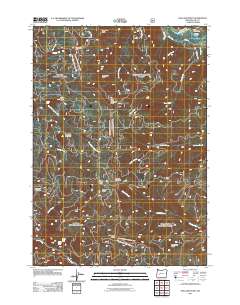
2011 Map of Holland Point
USGS Topo · Published 2011About this map
The Middle Fork Willamette River defines the northern edge of this high-elevation terrain in Lane County, where the Barnard Bridge and Errin Campground provide access to a complex network of forest roads. The landscape is characterized by prominent peaks and ridges such as Holland Point, Swastika Mountain, and Dinner Ridge, creating a watershed that feeds numerous creeks including Layng Creek and Gray Creek.
Find a feature on this map
32 named features on this map. Tap any name to fly to it.
Don’t see what you’re looking for? This feature index may not catch every label — zoom into the map to look around manually.
Map Details
Editions of this 2011 Holland Point Map
This is the sole edition of this map. No revisions or reprints were ever made.
Other maps of this area

1925 · Waldo Lake
USGS Topo · 1:125,000

1935 · Lowell
USGS Topo · 1:96,000

1942 · Lowell
USGS Topo · 1:125,000

1955 · Hardesty Mtn
USGS Topo · 1:62,500

1955 · Fairview Peak
USGS Topo · 1:62,500

1956 · Oakridge
USGS Topo · 1:62,500

1956 · Sardine Butte
USGS Topo · 1:62,500

1958 · Roseburg
USGS Topo · 1:250,000

1959 · Roseburg
USGS Topo · 1:250,000

1983 · Oakridge
USGS Topo · 1:100,000