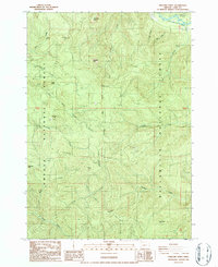
1986 Map of Holland Point
USGS Topo · Published 1987About this map
Willamette National Forest and Umpqua National Forest converge in this high-elevation timberland survey of the Cascades during the mid-1980s. The landscape is defined by the heavy drainage of the M Fk Willamette River and Brice Creek, carving deep valleys between prominent peaks like Deception Butte and Swastika Mtn. A network of logging roads and trails traverses the steep terrain, linking natural landmarks such as Moon Falls and Holland Meadows. A solitary Quarry and the Ferrin Picnic Area indicate the dual-use nature of these public lands, balancing industrial resource extraction with recreational access. The map captures the intricate hydrology of the Holland Ridge area, where numerous small tributaries like Alex Creek and Dinner Creek originate before descending toward the river valleys below.
Find a feature on this map
32 named features on this map. Tap any name to fly to it.
Don’t see what you’re looking for? This feature index may not catch every label — zoom into the map to look around manually.
Map Details
Editions of this 1986 Holland Point Map
This is the sole edition of this map. No revisions or reprints were ever made.
Other maps of this area

1925 · Waldo Lake
USGS Topo · 1:125,000

1935 · Lowell
USGS Topo · 1:96,000

1942 · Lowell
USGS Topo · 1:125,000

1955 · Hardesty Mtn
USGS Topo · 1:62,500

1955 · Fairview Peak
USGS Topo · 1:62,500

1956 · Oakridge
USGS Topo · 1:62,500

1956 · Sardine Butte
USGS Topo · 1:62,500

1958 · Roseburg
USGS Topo · 1:250,000

1959 · Roseburg
USGS Topo · 1:250,000

1983 · Oakridge
USGS Topo · 1:100,000