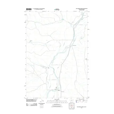
2011 Map of Hollenbeck Draw
USGS Topo · Published 2011About this map
The Clarks Fork Yellowstone River carves a central path through this landscape, defining the agricultural and logistical layout of the region. Near the small settlement of Chance, a sophisticated network of irrigation infrastructure is visible, including the Wills Ditch, Interstate Ditch, and Sirrine Ditch. These waterways support the arid valley floor, where landmarks like the Wills Ditch Bridge and various reservoirs such as Monroe Reservoir and the V O Reservoir appear.
Find a feature on this map
35 named features on this map. Tap any name to fly to it.
Don’t see what you’re looking for? This feature index may not catch every label — zoom into the map to look around manually.
Map Details
Editions of this 2011 Hollenbeck Draw Map
This is the sole edition of this map. No revisions or reprints were ever made.
Other maps of this area

1944 · Red Lodge
USGS Topo · 1:62,500

1950 · Clark
USGS Topo · 1:62,500

1954 · Billings
USGS Topo · 1:250,000

1955 · Cody
USGS Topo · 1:250,000

1957 · Billings
USGS Topo · 1:250,000

1958 · Billings
USGS Topo · 1:250,000

1958 · Cody
USGS Topo · 1:250,000

1962 · Cody
USGS Topo · 1:250,000

1966 · Elk Basin NW
USGS Topo · 1:24,000
1969 · Tolman Flat
USGS Topo · 1:24,000