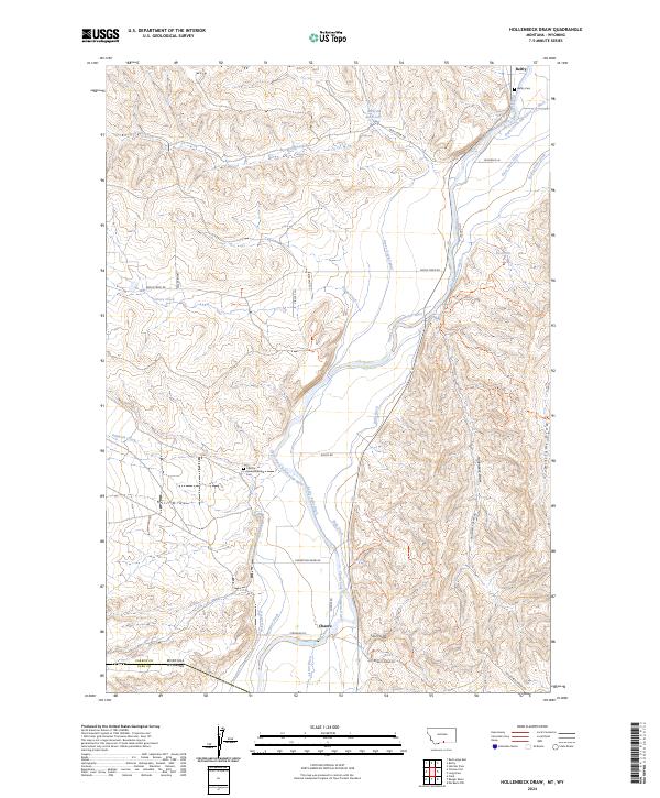
2024 Map of Hollenbeck Draw
USGS Topo · Published 2024About this map
The Clarks Fork Yellowstone River carves a deep valley through the Carbon County landscape, acting as the lifeblood for an extensive network of irrigation infrastructure including the Grove Creek Canal and Interstate Ditch. This 2024 survey documents the agricultural and ranching corridor between Belfry and the small settlement of Chance at the Montana-Wyoming border. The terrain is defined by dramatic drainage systems like Hollenbeck Draw and Sand Coulee that feed into the river basin from the surrounding high ground.
Find a feature on this map
45 named features on this map. Tap any name to fly to it.
Don’t see what you’re looking for? This feature index may not catch every label — zoom into the map to look around manually.
Map Details
Editions of this 2024 Hollenbeck Draw Map
This is the sole edition of this map. No revisions or reprints were ever made.
Other maps of this area

1944 · Red Lodge
USGS Topo · 1:62,500

1950 · Clark
USGS Topo · 1:62,500

1954 · Billings
USGS Topo · 1:250,000

1955 · Cody
USGS Topo · 1:250,000

1957 · Billings
USGS Topo · 1:250,000

1958 · Billings
USGS Topo · 1:250,000

1958 · Cody
USGS Topo · 1:250,000

1962 · Cody
USGS Topo · 1:250,000

1966 · Elk Basin NW
USGS Topo · 1:24,000
1969 · Tolman Flat
USGS Topo · 1:24,000