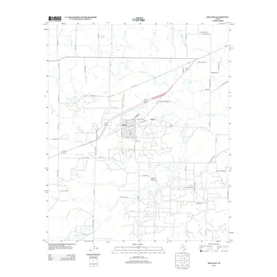
2012 Map of Holliday
USGS Topo · Published 2012About this map
Holliday serves as the central hub of this North Texas landscape, where the town's residential streets meet a landscape shaped by petroleum and water management. The mapping details several significant petroleum production areas, including the Holliday Oil Field, Daume Oil Field, and the Hull-Silk Oil Field, illustrating the deep-seated energy economy of Archer County. The presence of the Call Field Canal and Ca Lateral cutting across the northern reaches indicates a sophisticated irrigation or water transport system designed to support agriculture or industry in this semi-arid region. Beyond the settled areas of Holliday and Hartex, the terrain is defined by the winding paths of Holliday Cr and Pecan Cr. Local aviation and recreation are also represented, with Cactus Hill Airport and Lucky G Airport positioned near the northern boundary, and the Stonewall Jackson Campground situated along the creek south of town.
Find a feature on this map
70 named features on this map. Tap any name to fly to it.
Don’t see what you’re looking for? This feature index may not catch every label — zoom into the map to look around manually.
Map Details
Editions of this 2012 Holliday Map
This is the sole edition of this map. No revisions or reprints were ever made.
Other maps of this area

1916 · Iowa Park
USGS Topo · 1:24,000

1916 · Fowlkes
USGS Topo · 1:24,000

1918 · Iowa Park
USGS Topo · 1:31,680

1919 · Fowlkes
USGS Topo · 1:31,680

1931 · Archer City
USGS Topo · 1:62,500

1932 · Dundee
USGS Topo · 1:62,500

1954 · Wichita Falls
USGS Topo · 1:250,000

1956 · Lake Wichita
USGS Topo · 1:24,000

1957 · Wichita Falls West
USGS Topo · 1:24,000

1957 · Wichita Falls West
USGS Topo · 1:62,500