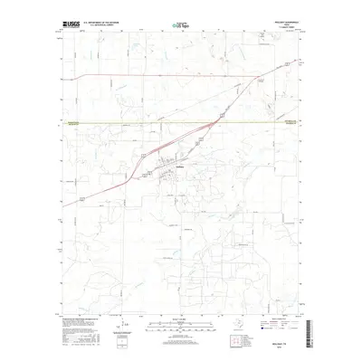
2016 Map of Holliday
USGS Topo · Published 2016About this map
The town of Holliday serves as the focal point for this 2016 survey, situated just south of the Wichita Co Archer Co boundary line. The landscape is defined by its intricate water management systems, notably the Call Field Canal and irrigation channels like the SZ Lateral and CA Lateral, which crisscross the agricultural terrain. Aviation history in this corner of North Texas is represented by Cactus Hill Airport and Lucky G Airport, both located in the northern half of the quadrangle.
Find a feature on this map
64 named features on this map. Tap any name to fly to it.
Don’t see what you’re looking for? This feature index may not catch every label — zoom into the map to look around manually.
Map Details
Editions of this 2016 Holliday Map
This is the sole edition of this map. No revisions or reprints were ever made.
Other maps of this area

1916 · Iowa Park
USGS Topo · 1:24,000

1916 · Fowlkes
USGS Topo · 1:24,000

1918 · Iowa Park
USGS Topo · 1:31,680

1919 · Fowlkes
USGS Topo · 1:31,680

1931 · Archer City
USGS Topo · 1:62,500

1932 · Dundee
USGS Topo · 1:62,500

1954 · Wichita Falls
USGS Topo · 1:250,000

1956 · Lake Wichita
USGS Topo · 1:24,000

1957 · Wichita Falls West
USGS Topo · 1:24,000

1957 · Wichita Falls West
USGS Topo · 1:62,500