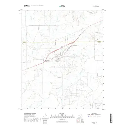
2019 Map of Holliday
USGS Topo · Published 2019About this map
The town of Holliday sits at the junction of Wichita Co and Archer Co in this 2019 topographic rendering. The landscape is defined by the winding paths of Holliday Cr, Panther Cr, and Pecan Cr, which drain the varied terrain of North Texas. Aviation infrastructure is prominent in the northern portion of the map with the inclusion of Cactus Hill Airport. A network of rural roads and highways, including FM 368, FM 440, and Old State Rd, connects the residential streets of the town center—such as North Main St and East Redwood St—to the outlying ranch lands. To the west, Antelope Cr and its E Fork Antelope Cr cut through the countryside near Republican Rd. This cartographic record provides a detailed look at the infrastructure and natural drainage patterns of the region as they existed in the late 2010s.
Find a feature on this map
67 named features on this map. Tap any name to fly to it.
Don’t see what you’re looking for? This feature index may not catch every label — zoom into the map to look around manually.
Map Details
Editions of this 2019 Holliday Map
This is the sole edition of this map. No revisions or reprints were ever made.
Other maps of this area

1916 · Iowa Park
USGS Topo · 1:24,000

1916 · Fowlkes
USGS Topo · 1:24,000

1918 · Iowa Park
USGS Topo · 1:31,680

1919 · Fowlkes
USGS Topo · 1:31,680

1931 · Archer City
USGS Topo · 1:62,500

1932 · Dundee
USGS Topo · 1:62,500

1954 · Wichita Falls
USGS Topo · 1:250,000

1956 · Lake Wichita
USGS Topo · 1:24,000

1957 · Wichita Falls West
USGS Topo · 1:24,000

1957 · Wichita Falls West
USGS Topo · 1:62,500