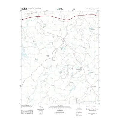
2011 Map of Hollis Crossroads
USGS Topo · Published 2011About this map
Horseblock Mountain and Ivory Mountain dominate this landscape in eastern Alabama, where the ridgelines are carved by Choccolocco Creek and Chulafinnee Creek. The terrain is marked by numerous small impoundments and named dams, reflecting a local economy and environment tied to water management, from Gold Mine Lakes to the series of reservoirs at White Lake Number 1 and White Lake Number 2. Small communities such as Hollis Crossroads and Chulafinnee anchor the road network, which includes the winding Skyway Mtwy and several county routes.
Find a feature on this map
66 named features on this map. Tap any name to fly to it.
Don’t see what you’re looking for? This feature index may not catch every label — zoom into the map to look around manually.
Map Details
Editions of this 2011 Hollis Crossroads Map
This is the sole edition of this map. No revisions or reprints were ever made.
Other maps of this area

1891 · Ashland
USGS Topo · 1:125,000

1900 · Anniston
USGS Topo · 1:125,000

1947 · Oxford
USGS Topo · 1:24,000

1947 · Anniston
USGS Topo · 1:24,000

1950 · Anniston
USGS Topo · 1:62,500

1953 · Atlanta
USGS Topo · 1:250,000

1954 · Choccolocco
USGS Topo · 1:24,000

1956 · Oxford
USGS Topo · 1:24,000

1956 · Anniston
USGS Topo · 1:24,000

1957 · Atlanta
USGS Topo · 1:250,000