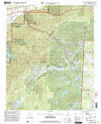
2001 Map of Hollis Crossroads
USGS Topo · Published 2004About this map
Talladega National Forest dominates this section of eastern Alabama, where the convergence of Cleburne, Calhoun, and Tallapoosa counties creates a landscape of ridges and creek valleys. The historic settlement of Chulafinnee sits near the namesake Chulafinnee Creek, while the community of Hollis Crossroads serves as a local hub further south. This 2001 revision by the USDA Forest Service emphasizes recreational and transport infrastructure, featuring the Pinhoti Trail as it winds through the interior alongside the Skyway Motorway. Local religious and educational life is grounded in several rural sites including Bethlehem Ch, Macedonia Ch, and the Pleasant Grove Jr High Sch. Water features like Abel Lake and Morgan Lake are interspersed throughout the forest, marking old drainage patterns and localized resource management in the post-war South.
Find a feature on this map
37 named features on this map. Tap any name to fly to it.
Don’t see what you’re looking for? This feature index may not catch every label — zoom into the map to look around manually.
Map Details
Editions of this 2001 Hollis Crossroads Map
This is the sole edition of this map. No revisions or reprints were ever made.
Other maps of this area

1891 · Ashland
USGS Topo · 1:125,000

1900 · Anniston
USGS Topo · 1:125,000

1947 · Oxford
USGS Topo · 1:24,000

1947 · Anniston
USGS Topo · 1:24,000

1950 · Anniston
USGS Topo · 1:62,500

1953 · Atlanta
USGS Topo · 1:250,000

1954 · Choccolocco
USGS Topo · 1:24,000

1956 · Oxford
USGS Topo · 1:24,000

1956 · Anniston
USGS Topo · 1:24,000

1957 · Atlanta
USGS Topo · 1:250,000