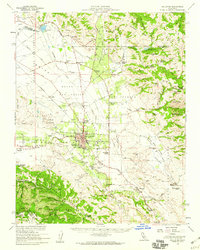
1955 Map of Hollister
USGS Topo · Published 1960About this map
Hollister serves as the focal point of this mid-century San Benito County survey, illustrating a period of significant regional growth before suburban expansion. The town center is densely detailed, featuring landmarks such as the San Benito Co HS & Jr Coll, Calvary Cem, and the Drive-in Theater. The surrounding landscape is a complex network of agricultural infrastructure and rural outposts, with numerous country schools like Pacheco Sch and Southside Sch serving outlying ranching communities.
Find a feature on this map
55 named features on this map. Tap any name to fly to it.
Don’t see what you’re looking for? This feature index may not catch every label — zoom into the map to look around manually.
Map Details
Editions of this 1955 Hollister Map
2 editions found
Other maps of this area

1910 · Salinas
USGS Topo · 1:31,680

1912 · Salinas
USGS Topo · 1:62,500

1915 · San Juan Bautista
USGS Topo · 1:48,000

1917 · Morgan Hill
USGS Topo · 1:62,500

1917 · San Juan Bautista
USGS Topo · 1:62,500

1919 · San Benito
USGS Topo · 1:62,500

1919 · Hollister
USGS Topo · 1:48,000

1920 · Pacheco Pass
USGS Topo · 1:62,500

1921 · Gonzales
USGS Topo · 1:62,500

1921 · Gilroy Hot Springs
USGS Topo · 1:62,500