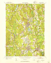
1953 Map of Holliston
USGS Topo · Published 1954About this map
The Charles River winds through the southern landscape of this 1953 survey, defining the industrial and residential corridors of West Medway and Medway. This mid-century view captures a network of mill-town infrastructure and early suburbanization, where the New York New Haven & Hartford RR and Boston & Albany RR provided vital connections for local industry. The village of Holliston serves as a central hub, flanked by the recreation area at Lake Winthrop and the rising ground of Mt Hollis.
Find a feature on this map
56 named features on this map. Tap any name to fly to it.
Don’t see what you’re looking for? This feature index may not catch every label — zoom into the map to look around manually.
Map Details
Editions of this 1953 Holliston Map
4 editions found
Other maps of this area

1886 · Blackstone
USGS Topo · 1:62,500

1886 · Framingham
USGS Topo · 1:62,500

1887 · Franklin
USGS Topo · 1:62,500

1887 · Marlboro
USGS Topo · 1:62,500

1889 · Marlboro
USGS Topo · 1:62,500

1889 · Blackstone
USGS Topo · 1:62,500

1889 · Franklin
USGS Topo · 1:62,500

1889 · Framingham
USGS Topo · 1:62,500

1893 · Franklin
USGS Topo · 1:62,500

1893 · Blackstone
USGS Topo · 1:62,500