
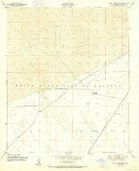
1948 Map of Holloman
USGS Topo · Published 1956About this map
Holloman Air Force Base dominates the central portion of this 1948 survey, reflecting the rapid expansion of military and aerospace testing in the New Mexico desert following World War II. The landscape is a mix of tactical installations and natural phenomena, with the Proving Ground and Alamogordo Bombing Range overlapping the shifting geography of the White Sands. Detailed labels reveal a specialized environment of research and defense, including a Radio Beam Sta, a Rifle Range, and even a Jeep Target.
Find a feature on this map
38 named features on this map. Tap any name to fly to it.
Don’t see what you’re looking for? This feature index may not catch every label — zoom into the map to look around manually.
Map Details
Editions of this 1948 Holloman Map
This is the sole edition of this map. No revisions or reprints were ever made.
Other maps of this area

1916 · Tularosa
USGS Topo · 1:125,000

1916 · Point Of Sands
USGS Topo · 1:125,000

1947 · Point Of Sands 2
USGS Topo · 1:62,500

1947 · Lake Lucero
USGS Topo · 1:62,500

1948 · Tres Hermanos
USGS Topo · 1:62,500

1948 · Lumley Lake
USGS Topo · 1:62,500

1948 · Tularosa
USGS Topo · 1:62,500
1950 · Lake Lucero NE
USGS Topo · 1:24,000

1950 · Escondido Canyon
USGS Topo · 1:62,500

1950 · Alamogordo
USGS Topo · 1:62,500