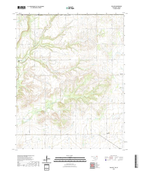
2022 Map of Hollow
USGS Topo · Published 2022About this map
Hollow and Banzet are the primary points of settlement in this part of Craig County, situated just south of the Kansas border. The landscape is defined by a dendritic network of streams and creeks, most notably Big Cabin Creek and the meandering path of Big Creek. This 2022 survey documents a rural expanse in northeastern Oklahoma, where the land is partitioned into a strict grid of county roads, such as S 4320 Road and E 40 Road, which serve isolated farmsteads and agricultural plots. The inclusion of Petit Cemetery provides a specific point of interest for genealogists tracing family histories in this corner of the state. The terrain across Township 29 North, Range 18 East and adjacent ranges is characterized by gentle elevation changes between the numerous drainage branches like Boggs Branch and Clear Creek.
Find a feature on this map
38 named features on this map. Tap any name to fly to it.
Don’t see what you’re looking for? This feature index may not catch every label — zoom into the map to look around manually.
Map Details
Editions of this 2022 Hollow Map
This is the sole edition of this map. No revisions or reprints were ever made.
Other maps of this area

1886 · Parsons
USGS Topo · 1:125,000

1893 · Parsons
USGS Topo · 1:125,000

1901 · Vinita
USGS Topo · 1:125,000

1913 · Vinita
USGS Topo · 1:125,000

1944 · Oswego
USGS Topo · 1:62,500

1946 · Oswego
USGS Topo · 1:48,000

1946 · Mound Valley
USGS Topo · 1:62,500

1947 · Joplin
USGS Topo · 1:250,000
1948 · Oswego
USGS Topo · 1:62,500
1948 · Mound Valley
USGS Topo · 1:62,500