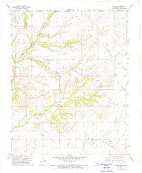
1972 Map of Hollow
USGS Topo · Published 1974About this map
Big Creek and its many tributaries, including Boggs Branch and East Fork Big Creek, carve a detailed drainage network across this borderland between Oklahoma and Kansas. The terrain is dotted with markers of early 1970s rural life, from the scattered homes of Hollow to the Ideal Sch and Bethel Ch located further north. This area reflects a quiet agricultural and industrial transition, where traditional homesteads and a local Cem exist alongside evidence of resource exploration like a prominent Oil Well and Drill Hole. The southern portion of the map is defined by the winding course of Clear Creek, which leads toward a Gaging Station near the settlement of Hollow, highlighting the importance of water management in this prairie landscape. The proximity to the state line and the intersection of Labette and Craig Counties underscores the map's value for tracing local property and political boundaries in the 1970s.
Find a feature on this map
15 named features on this map. Tap any name to fly to it.
Don’t see what you’re looking for? This feature index may not catch every label — zoom into the map to look around manually.
Map Details
Editions of this 1972 Hollow Map
This is the sole edition of this map. No revisions or reprints were ever made.
Other maps of this area

1886 · Parsons
USGS Topo · 1:125,000

1893 · Parsons
USGS Topo · 1:125,000

1901 · Vinita
USGS Topo · 1:125,000

1913 · Vinita
USGS Topo · 1:125,000

1944 · Oswego
USGS Topo · 1:62,500

1946 · Oswego
USGS Topo · 1:48,000

1946 · Mound Valley
USGS Topo · 1:62,500

1947 · Joplin
USGS Topo · 1:250,000
1948 · Oswego
USGS Topo · 1:62,500
1948 · Mound Valley
USGS Topo · 1:62,500