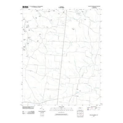
2010 Map of Hollow Springs
USGS Topo · Published 2010About this map
King Cemetery and Smithson Cemetery anchor the northern landscape of this region, where a dense network of hollows and ridges characterizes the Tennessee terrain. Family-named landmarks such as Shelton Hollow, Jakes Hollow, and Billy Hill Hollow reflect a long history of local settlement and land use. Water resources are central to the area's geography, ranging from the Lake Ann Dam in the north to the southern reaches of Liberty Lake and the Pocahontas Branch. A sophisticated grid of rural roads, including Hollow Springs Rd and Ivy Bluff Rd, connects isolated family cemeteries like Lorance Cemetery and Espy Cemetery with broader agricultural tracts. The geography transitions from the elevated Rains Ridge and Craft Hill down into several creek systems, most notably Duke Creek and McMahan Creek, which dictate the placement of early homesteads and transport routes.
Find a feature on this map
101 named features on this map. Tap any name to fly to it.
Don’t see what you’re looking for? This feature index may not catch every label — zoom into the map to look around manually.
Map Details
Editions of this 2010 Hollow Springs Map
This is the sole edition of this map. No revisions or reprints were ever made.
Other maps of this area

1893 · Mc Minnville
USGS Topo · 1:125,000

1895 · Mc Minnville
USGS Topo · 1:125,000

1908 · Woodbury
USGS Topo · 1:62,500

1913 · Hollow Springs
USGS Topo · 1:62,500

1936 · Fredonia
USGS Topo · 1:24,000

1936 · Beech Grove
USGS Topo · 1:24,000

1936 · Petty Gap
USGS Topo · 1:24,000

1936 · Noah
USGS Topo · 1:24,000

1936 · Morrison
USGS Topo · 1:24,000

1942 · Statesville
USGS Topo · 1:100,000