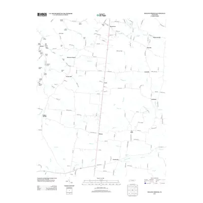
2013 Map of Hollow Springs
USGS Topo · Published 2013About this map
Hollow Springs and the surrounding Cannon County landscape are defined by a complex network of ridges and hollows where small rural settlements have persisted for generations. In the northern reaches, Wildwood Mill and Mooretown sit near the headwaters of Redman Br and Bullpen Cr, illustrating the historical reliance on local water sources. The terrain is marked by numerous named features like Sinkhole Ridge, Rains Ridge, and Whiteoak Slash, suggesting a geography where drainage and elevation dictated the placement of homesteads and roads. To the south, communities such as Ivy Bluff, Midway, and Pocahontas are connected by winding routes like Hollow Springs Rd. This 2013 survey provides a clear look at the persistent rural character of the region, where family-named landmarks like Bob Williams Hollow and Sissom Hollow preserve the genealogical heritage of the area's early inhabitants.
Find a feature on this map
167 named features on this map. Tap any name to fly to it.
Don’t see what you’re looking for? This feature index may not catch every label — zoom into the map to look around manually.
Map Details
Editions of this 2013 Hollow Springs Map
This is the sole edition of this map. No revisions or reprints were ever made.
Other maps of this area

1893 · Mc Minnville
USGS Topo · 1:125,000

1895 · Mc Minnville
USGS Topo · 1:125,000

1908 · Woodbury
USGS Topo · 1:62,500

1913 · Hollow Springs
USGS Topo · 1:62,500

1936 · Fredonia
USGS Topo · 1:24,000

1936 · Beech Grove
USGS Topo · 1:24,000

1936 · Petty Gap
USGS Topo · 1:24,000

1936 · Noah
USGS Topo · 1:24,000

1936 · Morrison
USGS Topo · 1:24,000

1942 · Statesville
USGS Topo · 1:100,000