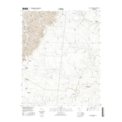
2016 Map of Hollow Springs
USGS Topo · Published 2016About this map
Pocahontas and Ivy Bluff anchor this landscape along the boundary where Cannon Co and Coffee Co meet. The terrain is defined by the Tennessee Valley Divide, which separates the high, broken ridges of the Carson Hills from the more level plateaus to the east. Numerous small family cemeteries like Milligan Cem, Smithson Cem, and Hopewell Cem are scattered across the quadrangle, indicating a long-established pattern of rural settlement.
Find a feature on this map
133 named features on this map. Tap any name to fly to it.
Don’t see what you’re looking for? This feature index may not catch every label — zoom into the map to look around manually.
Map Details
Editions of this 2016 Hollow Springs Map
This is the sole edition of this map. No revisions or reprints were ever made.
Other maps of this area

1893 · Mc Minnville
USGS Topo · 1:125,000

1895 · Mc Minnville
USGS Topo · 1:125,000

1908 · Woodbury
USGS Topo · 1:62,500

1913 · Hollow Springs
USGS Topo · 1:62,500

1936 · Fredonia
USGS Topo · 1:24,000

1936 · Beech Grove
USGS Topo · 1:24,000

1936 · Petty Gap
USGS Topo · 1:24,000

1936 · Noah
USGS Topo · 1:24,000

1936 · Morrison
USGS Topo · 1:24,000

1942 · Statesville
USGS Topo · 1:100,000