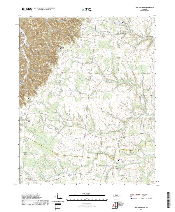
2022 Map of Hollow Springs
USGS Topo · Published 2022About this map
Ivy Bluff and Pocahontas anchor the eastern and southern reaches of this landscape, situated near the winding course of Duke Cr and Pocahontas Br. The terrain is defined by the Tennessee Valley Divide, which separates the elevated ridges of the northwest from the more gradual drainages to the southeast. To the north, the land rises into the Carson Hills and Rains Ridge, where numerous named hollows like Carrick Hollow and Shelton Hollow cut through the upland.
Find a feature on this map
145 named features on this map. Tap any name to fly to it.
Don’t see what you’re looking for? This feature index may not catch every label — zoom into the map to look around manually.
Map Details
Editions of this 2022 Hollow Springs Map
This is the sole edition of this map. No revisions or reprints were ever made.
Other maps of this area

1893 · Mc Minnville
USGS Topo · 1:125,000

1895 · Mc Minnville
USGS Topo · 1:125,000

1908 · Woodbury
USGS Topo · 1:62,500

1913 · Hollow Springs
USGS Topo · 1:62,500

1936 · Fredonia
USGS Topo · 1:24,000

1936 · Beech Grove
USGS Topo · 1:24,000

1936 · Petty Gap
USGS Topo · 1:24,000

1936 · Noah
USGS Topo · 1:24,000

1936 · Morrison
USGS Topo · 1:24,000

1942 · Statesville
USGS Topo · 1:100,000