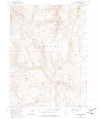
1980 Map of Holloway Meadows
USGS Topo · Published 1981About this map
The Santa Rosa Range and East Pasture Range converge in this high-desert landscape within the Humboldt National Forest. The geography is defined by a network of seasonal water sources and distinct mountain ridges, including Staunton Ridge and Black Ridge. The drainage patterns here are particularly notable, showing the headwaters and tributaries of both the South Fork Quinn River and the Little Humboldt River.
Find a feature on this map
32 named features on this map. Tap any name to fly to it.
Don’t see what you’re looking for? This feature index may not catch every label — zoom into the map to look around manually.
Map Details
Editions of this 1980 Holloway Meadows Map
This is the sole edition of this map. No revisions or reprints were ever made.
Other maps of this area

1882 · Paradise
USGS Topo · 1:250,000

1893 · Paradise
USGS Topo · 1:250,000

1955 · McDermitt
USGS Topo · 1:250,000

1959 · McDermitt
USGS Topo · 1:250,000

1959 · McDermitt
USGS Topo · 1:62,500

1959 · Hinkey Summit
USGS Topo · 1:62,500

1980 · Odell Mountain
USGS Topo · 1:24,000

1980 · Capitol Peak
USGS Topo · 1:24,000

1980 · Mahogany Spring
USGS Topo · 1:24,000

1980 · Black Ridge
USGS Topo · 1:24,000