
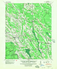
1940 Map of Holly Grove
USGS Topo · Published 1942About this map
Holly Grove serves as the central hub of this Delta landscape at the start of the 1940s, situated at the junction of the Missouri Pacific Railroad and the Arkansas And Louisiana Railway. The map reveals a dense network of rural community centers, particularly noted by the frequency of combined institutions like the Mt Olive Ch & Sch and Pine Ridge Ch & Cem. These clusters suggest a landscape where church, school, and cemetery formed the primary social anchors for a distributed agricultural population.
Find a feature on this map
84 named features on this map. Tap any name to fly to it.
Don’t see what you’re looking for? This feature index may not catch every label — zoom into the map to look around manually.
Map Details
Editions of this 1940 Holly Grove Map
2 editions found
Other maps of this area

1935 · Clarendon
USGS Topo · 1:62,500

1939 · Modoc
USGS Topo · 1:62,500

1939 · Indian Bay
USGS Topo · 1:62,500

1940 · Marvell
USGS Topo · 1:62,500

1940 · Brinkley
USGS Topo · 1:62,500

1940 · Marianna
USGS Topo · 1:62,500

1941 · De Witt
USGS Topo · 1:62,500

1941 · De Valls Bluff
USGS Topo · 1:62,500

1941 · Clarendon
USGS Topo · 1:62,500

1948 · Helena
USGS Topo · 1:250,000