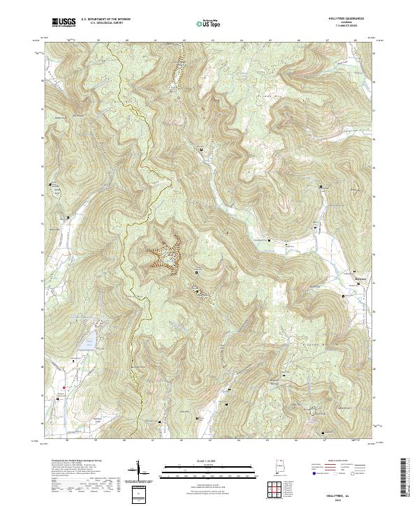
2024 Map of Hollytree
USGS Topo · Published 2024About this map
Paint Rock Valley serves as the focal point for this landscape in Jackson and Madison Counties, where the community of Hollytree sits at the foot of the surrounding highlands. The topography is defined by a series of karst features and complex drainage patterns, including Cunningham Sinks, Calloway Sinks, and Keel Sinks. These natural depressions illustrate the subterranean hydrology of the region, where water often disappears into the limestone before emerging in branches like Dry Creek or Williams Creek.
Find a feature on this map
130 named features on this map. Tap any name to fly to it.
Don’t see what you’re looking for? This feature index may not catch every label — zoom into the map to look around manually.
Map Details
Editions of this 2024 Hollytree Map
This is the sole edition of this map. No revisions or reprints were ever made.
Other maps of this area

1888 · Scottsboro
USGS Topo · 1:125,000

1892 · Scottsboro
USGS Topo · 1:125,000

1936 · King Cove
USGS Topo · 1:24,000

1936 · Moontown
USGS Topo · 1:24,000

1936 · Hollytree
USGS Topo · 1:24,000

1936 · Princeton
USGS Topo · 1:24,000

1936 · Lim Rock
USGS Topo · 1:24,000

1936 · Maysville
USGS Topo · 1:24,000
1936 · New Market
USGS Topo · 1:24,000
1936 · Paint Rock
USGS Topo · 1:24,000