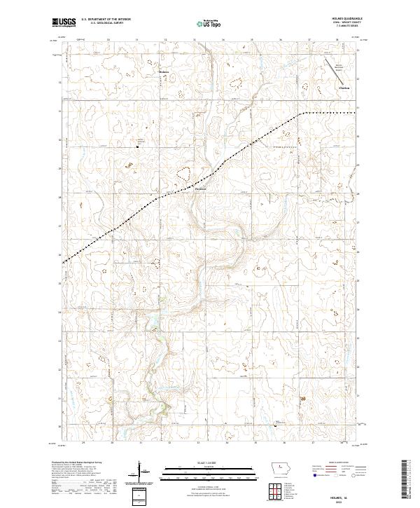
2022 Map of Holmes
USGS Topo · Published 2022About this map
Agricultural patterns in Wright County are defined by an extensive network of water management, where Eagle Cr and Little Eagle Cr are supplemented by a complex grid of drainage infrastructure such as Ditch Number 192 and Ditch Number 36. The prairie landscape is organized by the Public Land Survey System, with gravel and paved roads following section lines to connect small rural centers. The settlement of Holmes serves as a local focal point near the Holmes Lutheran Cem, while the western edge of Clarion begins to appear in the northeast, marked by the Clarion Municipal Airport. Small hamlets like Florence sit at crossroads, illustrating the enduring township-and-range layout of the Iowa heartland. Genealogists can locate specific burial grounds including Saint Josephs Cem situated near the southern boundary along Co Rd C60.
Find a feature on this map
34 named features on this map. Tap any name to fly to it.
Don’t see what you’re looking for? This feature index may not catch every label — zoom into the map to look around manually.
Map Details
Editions of this 2022 Holmes Map
This is the sole edition of this map. No revisions or reprints were ever made.
Other maps of this area

1954 · Waterloo
USGS Topo · 1:250,000

1955 · Waterloo
USGS Topo · 1:250,000

1972 · Kanawha SE
USGS Topo · 1:24,000

1972 · Cornelia
USGS Topo · 1:24,000

1972 · Renwick
USGS Topo · 1:24,000

1978 · Holmes
USGS Topo · 1:24,000

1978 · Woolstock
USGS Topo · 1:24,000

1978 · Clarion
USGS Topo · 1:24,000

1978 · Eagle Grove SW
USGS Topo · 1:24,000

1978 · Clarion SW
USGS Topo · 1:24,000