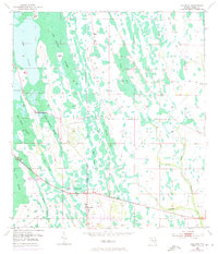
1953 Map of Holopaw
USGS Topo · Published 1972About this map
Holopaw serves as the primary hub in this corner of Osceola County, situated at the junction of regional transport routes during the mid-century era. The landscape is defined by an intricate network of wetlands and seasonal drainages, where named features like Grape Hammock Slough and Myrtle Slough provide natural corridors through the hammocks. To the north, Lake Conlin and the expansive Cat Island Swamp dominate the terrain, surrounding the isolated elevation of Cat Island. These features illustrate the traditional Florida interior before large-scale drainage projects significantly altered the hydrology of the upper St. Johns River basin. The presence of smaller landmarks such as Storey Bend and Rocky Pond suggests localized activity and named points of reference for early residents navigating this water-logged geography.
Find a feature on this map
19 named features on this map. Tap any name to fly to it.
Don’t see what you’re looking for? This feature index may not catch every label — zoom into the map to look around manually.
Map Details
Editions of this 1953 Holopaw Map
2 editions found
Other maps of this area

1953 · Holopaw SE
USGS Topo · 1:24,000

1953 · Narcoossee SE
USGS Topo · 1:24,000

1953 · Narcoossee
USGS Topo · 1:24,000

1953 · Deer Park NW
USGS Topo · 1:24,000

1953 · Holopaw SW
USGS Topo · 1:24,000

1953 · Lake Poinsett SW
USGS Topo · 1:24,000

1953 · Deer Park
USGS Topo · 1:24,000

1953 · Ashton
USGS Topo · 1:24,000

1953 · Holopaw
USGS Topo · 1:24,000

1955 · Orlando
USGS Topo · 1:250,000