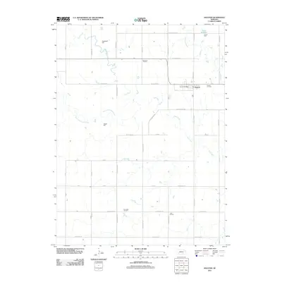
2011 Map of Holstein
USGS Topo · Published 2011About this map
Holstein sits at the heart of this agrarian landscape, serving as a primary focal point for the surrounding Nebraska plains. The settlement’s infrastructure is anchored by the Holstein Post Office and nearby Holstein Cemetery, while the broader terrain is defined by the winding paths of Sand Creek and its South Branch. The grid-like road network reflects the region’s heritage, featuring evocative names such as W Oregon Trail Rd and W Pony Express Rd, which hint at the historic transport corridors that once crossed this territory.
Find a feature on this map
37 named features on this map. Tap any name to fly to it.
Don’t see what you’re looking for? This feature index may not catch every label — zoom into the map to look around manually.
Map Details
Editions of this 2011 Holstein Map
This is the sole edition of this map. No revisions or reprints were ever made.
Other maps of this area

1894 · Kenesaw
USGS Topo · 1:62,500

1894 · Minden
USGS Topo · 1:62,500

1896 · Wood River
USGS Topo · 1:125,000

1897 · Red Cloud
USGS Topo · 1:125,000

1955 · Grand Island
USGS Topo · 1:250,000

1957 · Grand Island
USGS Topo · 1:250,000

1958 · Grand Island
USGS Topo · 1:250,000

1969 · Upland SE
USGS Topo · 1:24,000
1969 · Holstein
USGS Topo · 1:24,000
1969 · Roseland
USGS Topo · 1:24,000