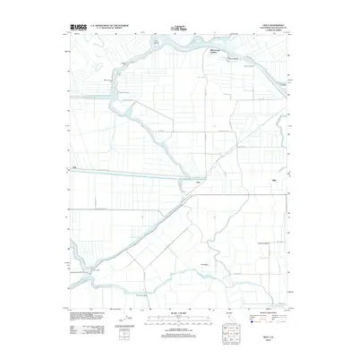
2012 Map of Holt
USGS Topo · Published 2012About this map
The San Joaquin River and Middle River wind through the complex delta lands west of Stockton, defining a landscape of low-lying islands and fertile tracts. This 2012 survey reveals the intricate network of waterways and levees essential to the region's agricultural character, featuring prominent landmarks like Vulcan Island and Acker Island. Local transport and commerce are anchored by the settlement of Holt and various water-access points such as Blackslough Landing and Eldorado Landing. The engineering of the Mokelumne Aqueduct cuts a straight path across the terrain, contrasting with the meandering natural sloughs. Genealogists and historians can trace the rural infrastructure of San Joaquin County, from the McDonald Island Ferry to small railroad-aligned sites like Gillis and Trull, which reflect the area's long-standing reliance on river-and-rail connectivity.
Find a feature on this map
49 named features on this map. Tap any name to fly to it.
Don’t see what you’re looking for? This feature index may not catch every label — zoom into the map to look around manually.
Map Details
Editions of this 2012 Holt Map
This is the sole edition of this map. No revisions or reprints were ever made.
Other maps of this area

1894 · Lodi
USGS Topo · 1:125,000

1910 · Castle
USGS Topo · 1:31,680

1910 · Bouldin
USGS Topo · 1:31,680

1910 · Headreach
USGS Topo · 1:31,680

1913 · Woodward Island
USGS Topo · 1:31,680

1913 · Stockton
USGS Topo · 1:31,680

1913 · Holt
USGS Topo · 1:31,680

1914 · Bethany
USGS Topo · 1:31,680

1914 · Union Island
USGS Topo · 1:31,680

1915 · Lathrop
USGS Topo · 1:31,680