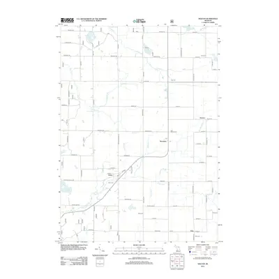
2012 Map of Holton
USGS Topo · Published 2012About this map
Holton serves as the primary hub of this landscape, where the local post office and Holton Cem mark the community's center. The surrounding terrain is defined by a dense network of drainage systems and small lakes, including Horseshoe Lake, Acker Lake, and Unger Lake. Smaller settlements like Brunswick, Reeman, and Sitka are connected by a grid of rural roads, such as Roosevelt Rd and Brunswick Rd, reflecting the area's agricultural and residential layout. The mapping of numerous local drains, such as Brayton Drain, Ruper Drain, and Hoffman Drain, illustrates the complex water management required for this part of Muskegon County. Genealogists will find significant value in the distribution of family and community burial sites, including Saint Michaels Cem, Evans Cem, and Wilde Cem, which are scattered throughout the rural sections.
Find a feature on this map
62 named features on this map. Tap any name to fly to it.
Don’t see what you’re looking for? This feature index may not catch every label — zoom into the map to look around manually.
Map Details
Editions of this 2012 Holton Map
This is the sole edition of this map. No revisions or reprints were ever made.
Other maps of this area

1931 · Walkerville SW
USGS Topo · 1:31,680

1931 · Walkerville SE
USGS Topo · 1:31,680

1954 · Milwaukee
USGS Topo · 1:250,000

1954 · Midland
USGS Topo · 1:250,000

1958 · Midland
USGS Topo · 1:250,000

1958 · Milwaukee
USGS Topo · 1:250,000

1958 · Hesperia
USGS Topo · 1:62,500

1958 · Twin Lake
USGS Topo · 1:62,500

1958 · Fremont
USGS Topo · 1:62,500

1959 · Midland
USGS Topo · 1:250,000