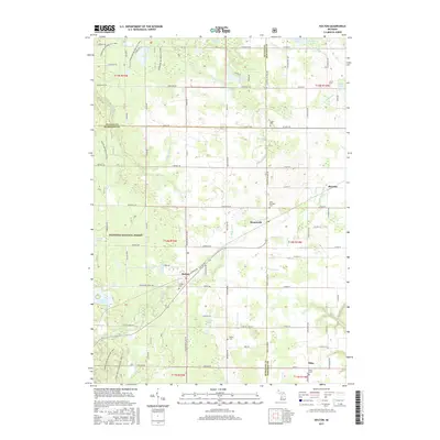
2017 Map of Holton
USGS Topo · Published 2017About this map
The Manistee National Forest covers much of this landscape, where the borders of Muskegon, Newaygo, and Oceana Counties meet. This 2017 study illustrates the rural character of the region, anchored by the unincorporated communities of Holton, Brunswick, and Sitka. The terrain is defined by an intricate network of managed waterways, including the Folsom Drain, Dobie Drain, and Robinson Drain, which move water through low-lying areas like Cushman Swamp. For genealogists and local researchers, the map provides precise locations for several community burial grounds, such as Saint Michaels Cem near Brunswick and Wilde Cem to the south. Modern recreational use is visible through the Cedar Creek Motorsport Trail and the Horseshoe Motorcycle Trail, reflecting how these wooded tracts serve as both natural preserves and active outdoor spaces.
Find a feature on this map
75 named features on this map. Tap any name to fly to it.
Don’t see what you’re looking for? This feature index may not catch every label — zoom into the map to look around manually.
Map Details
Editions of this 2017 Holton Map
This is the sole edition of this map. No revisions or reprints were ever made.
Other maps of this area

1931 · Walkerville SW
USGS Topo · 1:31,680

1931 · Walkerville SE
USGS Topo · 1:31,680

1954 · Milwaukee
USGS Topo · 1:250,000

1954 · Midland
USGS Topo · 1:250,000

1958 · Midland
USGS Topo · 1:250,000

1958 · Milwaukee
USGS Topo · 1:250,000

1958 · Hesperia
USGS Topo · 1:62,500

1958 · Twin Lake
USGS Topo · 1:62,500

1958 · Fremont
USGS Topo · 1:62,500

1959 · Midland
USGS Topo · 1:250,000