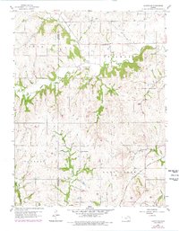
1960 Map of Holton SE
USGS Topo · Published 1978About this map
North Cedar Creek and South Cedar Creek converge in this rural expanse along the border of Jackson and Jefferson counties. The landscape is defined by the deeply etched drainage basins of Rock Creek and Duck Creek, where the terrain transitions from agricultural uplands into wooded valley slopes. Local social and spiritual centers appear in the form of the United Brethren Ch and Graggs Chapel Cem, providing essential points of reference for genealogists tracing family ties in the Cedar and Delaware townships. Industrial activity is represented by scattered Quarries, while the southeastern corner is cut by the steel of the Atchison Topeka and Santa Fe railroad, marking the corridor of regional transit and trade that connected these farmsteads to larger Kansas markets during the mid-twentieth century.
Find a feature on this map
18 named features on this map. Tap any name to fly to it.
Don’t see what you’re looking for? This feature index may not catch every label — zoom into the map to look around manually.
Map Details
Editions of this 1960 Holton SE Map
2 editions found
Other maps of this area

1886 · Oskaloosa
USGS Topo · 1:125,000

1888 · Oskaloosa
USGS Topo · 1:125,000

1889 · Topeka
USGS Topo · 1:125,000

1894 · Oskaloosa
USGS Topo · 1:125,000

1894 · Topeka
USGS Topo · 1:125,000

1950 · Kansas City
USGS Topo · 1:250,000

1951 · Ozawkie
USGS Topo · 1:24,000

1952 · Elmont
USGS Topo · 1:24,000
1952 · Meriden
USGS Topo · 1:24,000

1954 · Kansas City
USGS Topo · 1:250,000