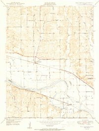
1950 Map of Willliamstown
USGS Topo · Published 1950About this map
Williamstown sits as a central junction where the Union Pacific railroad corridor meets the rural landscape of Jefferson County. The 1950 landscape is defined by the broad curves of the Kansas River, which serves as a natural boundary between the townships of Kentucky, Rural, and Lecompton. The area's agricultural and social fabric is clearly visible through a dense network of country schoolhouses, including Clover Hill Sch, Buck Creek Sch, and Sunnyside Sch, highlighting the distributed nature of mid-century rural education before school consolidation.
Find a feature on this map
34 named features on this map. Tap any name to fly to it.
Don’t see what you’re looking for? This feature index may not catch every label — zoom into the map to look around manually.
Map Details
Editions of this 1950 Willliamstown Map
3 editions found

Other maps of this area

1885 · Lawrence
USGS Topo · 1:125,000

1886 · Oskaloosa
USGS Topo · 1:125,000

1888 · Oskaloosa
USGS Topo · 1:125,000

1889 · Lawrence
USGS Topo · 1:125,000

1894 · Oskaloosa
USGS Topo · 1:125,000

1947 · Lawrence
USGS Topo · 1:250,000

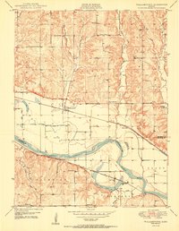
1949 · Williamstown
USGS Topo · 1:24,000

1949 · Perry
USGS Topo · 1:24,000

1950 · Perry
USGS Topo · 1:24,000

1950 · Kansas City
USGS Topo · 1:250,000