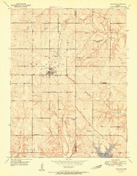
1951 Map of Mc Louth
USGS Topo · Published 1951About this map
The town of McLouth serves as the focal point for this 1951 survey of Jefferson and Leavenworth counties, situated near the historic Old Delaware Reservation North Boundary Line. The landscape is a network of small rural school districts and family-named landmarks, reflecting a mid-century agricultural community that relied heavily on local institutions. Country schools such as Wild Horse Sch and Brown Grove Sch dot the hills, while others like Eureka Sch (Abandoned) already signaled the shifts in rural education by the early 1950s.
Find a feature on this map
29 named features on this map. Tap any name to fly to it.
Don’t see what you’re looking for? This feature index may not catch every label — zoom into the map to look around manually.
Map Details
Editions of this 1951 Mc Louth Map
This is the sole edition of this map. No revisions or reprints were ever made.
Other maps of this area

1886 · Oskaloosa
USGS Topo · 1:125,000

1888 · Oskaloosa
USGS Topo · 1:125,000

1894 · Oskaloosa
USGS Topo · 1:125,000

1948 · Jarbalo
USGS Topo · 1:24,000

1949 · Williamstown
USGS Topo · 1:24,000

1950 · Kansas City
USGS Topo · 1:250,000

1950 · Easton
USGS Topo · 1:24,000

1950 · Williamstown
USGS Topo · 1:24,000
1950 · Jarbalo
USGS Topo · 1:24,000
1950 · Midland
USGS Topo · 1:24,000