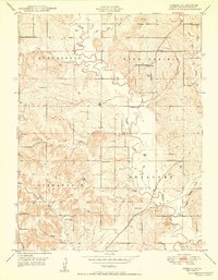
1950 Map of Jarbalo
USGS Topo · Published 1950About this map
Jarbalo serves as the central hub for this Leavenworth County landscape, where the rural topography is defined by the winding course of Stranger Creek and its many tributaries. The area is notable for its exceptionally dense network of local schoolhouses, including Centennial School, Star School, Elmwood School, and Smith School, which suggests a highly organized 19th-century district system still largely intact at the time of this 1948 field check. These small, scattered school sites, often located at crossroads like Five Points, provide valuable touchpoints for family historians.
Find a feature on this map
29 named features on this map. Tap any name to fly to it.
Don’t see what you’re looking for? This feature index may not catch every label — zoom into the map to look around manually.
Map Details
Editions of this 1950 Jarbalo Map
2 editions found
Other maps of this area

1886 · Oskaloosa
USGS Topo · 1:125,000

1888 · Oskaloosa
USGS Topo · 1:125,000

1890 · Kansas City
USGS Topo · 1:125,000

1894 · Kansas City
USGS Topo · 1:125,000

1894 · Oskaloosa
USGS Topo · 1:125,000

1910 · Leavenworth
USGS Topo · 1:62,500

1934 · Bonner Springs
USGS Topo · 1:48,000

1940 · Bonner Springs
USGS Topo · 1:62,500

1948 · Leavenworth
USGS Topo · 1:62,500

1948 · Jarbalo
USGS Topo · 1:24,000