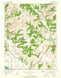
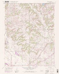
1950 Map of Midland
USGS Topo · Published 1966About this map
Midland and Kent anchor the southern reaches of this landscape where the Union Pacific railroad tracks follow the corridor created by the Wakarusa River and Mud Creek. The 1950 field check reveals a network of rural education, with schoolhouses such as Oak Ridge Sch, Mound Sch, and Bleakley Sch distributed across the townships of Sarcoxie, Tonganoxie, and Reno.
Find a feature on this map
35 named features on this map. Tap any name to fly to it.
Don’t see what you’re looking for? This feature index may not catch every label — zoom into the map to look around manually.
Map Details
Editions of this 1950 Midland Map
5 editions found
Other maps of this area

1885 · Lawrence
USGS Topo · 1:125,000

1886 · Oskaloosa
USGS Topo · 1:125,000

1888 · Oskaloosa
USGS Topo · 1:125,000

1889 · Lawrence
USGS Topo · 1:125,000

1894 · Oskaloosa
USGS Topo · 1:125,000

1947 · Lawrence
USGS Topo · 1:250,000

1948 · Jarbalo
USGS Topo · 1:24,000

1949 · Williamstown
USGS Topo · 1:24,000

1950 · Kansas City
USGS Topo · 1:250,000

1950 · Williamstown
USGS Topo · 1:24,000