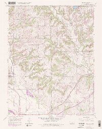
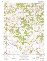
1950 Map of Midland
USGS Topo · Published 1978About this map
Midland sits at a crossroads of mid-century infrastructure where the Union Pacific railroad and Mud Creek converge. The landscape is defined by the transition from rural school districts to modern transport hubs, evidenced by the presence of the Lawrence Municipal Airport and the heavy line of the Kansas Turnpike. This 1950 survey, with revisions into the late 1970s, captures the evolution of the Kansas river valley as local institutions like Knowledge Hill Sch and Mound Sch were maintained alongside new developments like the Lawrence Service Area. The topographic detail highlights the winding path of the Kansas River and Wakarusa River in the south, while the northern reaches include Leavenworth State Park and Leavenworth State Lake. Small-scale agricultural life is noted through features such as Maple Grove Cem and various unnamed quarries.
Find a feature on this map
33 named features on this map. Tap any name to fly to it.
Don’t see what you’re looking for? This feature index may not catch every label — zoom into the map to look around manually.
Map Details
Editions of this 1950 Midland Map
5 editions found
Other maps of this area

1885 · Lawrence
USGS Topo · 1:125,000

1886 · Oskaloosa
USGS Topo · 1:125,000

1888 · Oskaloosa
USGS Topo · 1:125,000

1889 · Lawrence
USGS Topo · 1:125,000

1894 · Oskaloosa
USGS Topo · 1:125,000

1947 · Lawrence
USGS Topo · 1:250,000

1948 · Jarbalo
USGS Topo · 1:24,000

1949 · Williamstown
USGS Topo · 1:24,000

1950 · Kansas City
USGS Topo · 1:250,000

1950 · Williamstown
USGS Topo · 1:24,000