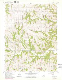
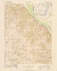
1961 Map of Easton SW
USGS Topo · Published 1979About this map
The Jefferson and Leavenworth County line bisects this agricultural landscape, where the townships of Easton, Alexandria, and Union converge. A dense network of stream valleys, including Buttermilk Creek, Dawson Creek, and Indian Creek, creates a complex drainage pattern across the central terrain. This 1961 field-checked survey, later updated in 1978, reveals the placement of rural community anchors such as Hebron Ch and several family or community burial grounds including Hulls Grove Cem, Langley Cem, and Wise Cem. The northern portion of the map highlights the proximity of Grange Hall School to the headwaters of Hulls Branch, illustrating the distributed nature of early social and educational life in this Kansas territory. Scattered farmsteads are connected by a system of unimproved dirt roads and section lines, reflecting a traditional mid-century Midwestern rural economy focused on the land and local parishes.
Find a feature on this map
21 named features on this map. Tap any name to fly to it.
Don’t see what you’re looking for? This feature index may not catch every label — zoom into the map to look around manually.
Map Details
Editions of this 1961 Easton SW Map
3 editions found
Other maps of this area

1886 · Oskaloosa
USGS Topo · 1:125,000

1888 · Oskaloosa
USGS Topo · 1:125,000

1894 · Oskaloosa
USGS Topo · 1:125,000

1948 · Oak Mills
USGS Topo · 1:24,000

1948 · Jarbalo
USGS Topo · 1:24,000

1950 · Kansas City
USGS Topo · 1:250,000

1950 · Easton
USGS Topo · 1:24,000
1950 · Jarbalo
USGS Topo · 1:24,000

1950 · Mc Louth
USGS Topo · 1:24,000
1951 · Oak Mills
USGS Topo · 1:24,000