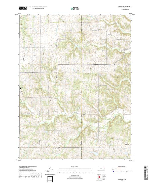
2022 Map of Easton SW
USGS Topo · Published 2022About this map
The rural boundary between Jefferson and Leavenworth counties is defined by a landscape of winding creek valleys and dispersed farmstead roads. In the northeast, the outskirts of Easton sit near the confluence of Buttermilk Cr and Dawson Cr, while the village of Springdale anchors the southeastern corner along Springdale Rd. This terrain is characterized by a dense network of watercourses, including Walnut Cr, Mooney Cr, and Indian Cr, which have historically dictated the placement of small local cemeteries and community landmarks. Researchers will find several family and church burial grounds scattered across the townships, such as Hull Grove Cem, Langley Cem, and Wise Cem, alongside the small-scale aviation strip at Sanders Airport. The map highlights a quintessential Kansas agricultural layout where section-line roads like Lecompton Rd and Limit Rd navigate the rolling drainage basins of the Missouri River watershed.
Find a feature on this map
48 named features on this map. Tap any name to fly to it.
Don’t see what you’re looking for? This feature index may not catch every label — zoom into the map to look around manually.
Map Details
Editions of this 2022 Easton SW Map
This is the sole edition of this map. No revisions or reprints were ever made.
Other maps of this area

1886 · Oskaloosa
USGS Topo · 1:125,000

1888 · Oskaloosa
USGS Topo · 1:125,000

1894 · Oskaloosa
USGS Topo · 1:125,000

1948 · Oak Mills
USGS Topo · 1:24,000

1948 · Jarbalo
USGS Topo · 1:24,000

1950 · Kansas City
USGS Topo · 1:250,000

1950 · Easton
USGS Topo · 1:24,000
1950 · Jarbalo
USGS Topo · 1:24,000

1950 · Mc Louth
USGS Topo · 1:24,000
1951 · Oak Mills
USGS Topo · 1:24,000