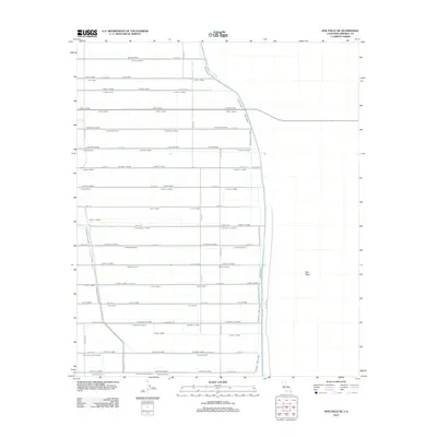
2012 Map of Holtville NE
USGS Topo · Published 2012About this map
East Mesa defines the eastern boundary of this highly structured agricultural landscape in Imperial County. The map reveals an intricate network of irrigation and drainage infrastructure essential for desert farming, including the Holtville Main Drain and Holtville Six Drain. The land is meticulously partitioned by a series of alphabetically named water features, such as the Orient Lateral, Occident Lateral, and Oasis Lateral, which run parallel to a rigid grid of rural roads. This pattern of water management illustrates the intensive engineering required to sustain cultivation in the arid region near the California-Mexico border. Local transport follows this same geometric precision, with routes like Highline Rd and Poore Rd serving the scattered farmsteads and fields that characterize the area's twentieth-century development.
Find a feature on this map
67 named features on this map. Tap any name to fly to it.
Don’t see what you’re looking for? This feature index may not catch every label — zoom into the map to look around manually.
Map Details
Editions of this 2012 Holtville NE Map
This is the sole edition of this map. No revisions or reprints were ever made.
Other maps of this area

1907 · Holtville
USGS Topo · 1:125,000

1940 · Iris
USGS Topo · 1:62,500

1940 · Alamorio
USGS Topo · 1:62,500

1942 · El Centro
USGS Topo · 1:250,000

1945 · Alamorio
USGS Topo · 1:62,500

1945 · Iris
USGS Topo · 1:62,500

1953 · Acolita
USGS Topo · 1:24,000

1953 · Acolita
USGS Topo · 1:62,500

1954 · El Centro
USGS Topo · 1:250,000

1954 · Salton Sea
USGS Topo · 1:250,000