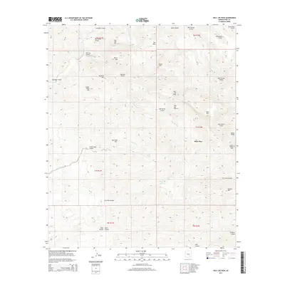
2014 Map of Holy Joe Peak
USGS Topo · Published 2014About this map
Blake Place serves as a lone human landmark in this section of Pinal County, where the landscape is defined by the branching drainages of the Galiuro Mountains. The terrain is a complex network of deep cuts including Aravaipa Canyon and Holy Joe Canyon, through which Aravaipa Cr and the Holy Joe Wash flow. This 2014 survey documents a region characterized by specialized land use, evidenced by named areas like Holy Joe Pasture and landmarks such as Mining Mtn. The naming conventions found throughout the quadrangle, from Negro Henry Canyon to Skeleton Canyon, suggest a deep layer of local history and early ranching or prospecting activity. Strategic water points like Moffit Tank and Buzzard Roost Spring are critical features in this arid environment, marking the traditional infrastructure required for movement and survival in the high desert.
Find a feature on this map
41 named features on this map. Tap any name to fly to it.
Don’t see what you’re looking for? This feature index may not catch every label — zoom into the map to look around manually.
Map Details
Editions of this 2014 Holy Joe Peak Map
This is the sole edition of this map. No revisions or reprints were ever made.
Other maps of this area

1911 · Winkelman
USGS Topo · 1:125,000

1913 · Winkelman
USGS Topo · 1:125,000

1938 · Galiuro Mts
USGS Topo · 1:48,000

1938 · Klondyke
USGS Topo · 1:48,000

1943 · Galiuro Mts
USGS Topo · 1:62,500

1943 · Klondyke
USGS Topo · 1:62,500

1948 · Clark Ranch
USGS Topo · 1:24,000

1948 · Mammoth
USGS Topo · 1:62,500

1948 · Mammoth
USGS Topo · 1:24,000

1949 · Clark Ranch
USGS Topo · 1:24,000