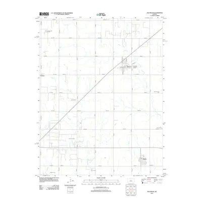
2012 Map of Holyrood
USGS Topo · Published 2012About this map
Holyrood and Bushton anchor this landscape of the central Kansas plains, where a precise grid of rural roads connects scattered settlements and intensive energy production. The region is defined by a dense network of petroleum extraction sites, including the Bloomer Oil Field, Kraft-Prusa Northeast Oil Field, and West Oil Field, which illustrate the industrial character of Ellsworth and Rice counties. These operations are interspersed among the drainages of Plum Cr and Calf Cr, showing the relationship between the natural prairie hydrology and the modern agricultural and mineral economy. Smaller named locales like Farhman and Cain provide points of reference for local historians, while the Holyrood Municipal Airport and the local Po serve as modern community hubs. In the southeastern portion of the quadrangle near Bushton, the Button Cem offers a grounded connection to the area's genealogical past.
Find a feature on this map
49 named features on this map. Tap any name to fly to it.
Don’t see what you’re looking for? This feature index may not catch every label — zoom into the map to look around manually.
Map Details
Editions of this 2012 Holyrood Map
This is the sole edition of this map. No revisions or reprints were ever made.
Other maps of this area

1891 · Great Bend
USGS Topo · 1:125,000

1893 · Great Bend
USGS Topo · 1:125,000

1894 · Ellsworth
USGS Topo · 1:125,000

1894 · Lyons
USGS Topo · 1:125,000

1896 · Russell
USGS Topo · 1:125,000

1955 · Great Bend
USGS Topo · 1:250,000

1956 · Ellinwood NE
USGS Topo · 1:24,000

1957 · Great Bend
USGS Topo · 1:250,000

1957 · Holyrood NE
USGS Topo · 1:24,000

1958 · Great Bend
USGS Topo · 1:250,000