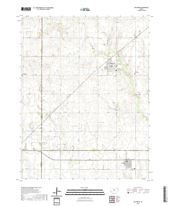
2022 Map of Holyrood
USGS Topo · Published 2022About this map
Holyrood serves as a central hub for this portion of the Kansas plains, situated at the intersection of several local routes such as Ave T and N Main St. The landscape is defined by the gentle drainage patterns of Plum Cr and Calf Cr, which wind through the agricultural sections. In the southeast, Bushton borders the Rice County line, anchored by the Bushton - Farmer Township Cem. The map provides significant genealogical value through its inclusion of several denominational burial grounds, including the Saint Peter Lutheran Cem and Saint Pauls United Church of Christ Cem. These sites, along with the small settlement of Farhman on the western edge, illustrate the tight-knit rural community structure that has persisted in this region. The layout of the road network, including W Santa Fe Ave, reflects the organized township-and-range surveying system characteristic of the Central Plains.
Find a feature on this map
53 named features on this map. Tap any name to fly to it.
Don’t see what you’re looking for? This feature index may not catch every label — zoom into the map to look around manually.
Map Details
Editions of this 2022 Holyrood Map
This is the sole edition of this map. No revisions or reprints were ever made.
Other maps of this area

1891 · Great Bend
USGS Topo · 1:125,000

1893 · Great Bend
USGS Topo · 1:125,000

1894 · Ellsworth
USGS Topo · 1:125,000

1894 · Lyons
USGS Topo · 1:125,000

1896 · Russell
USGS Topo · 1:125,000

1955 · Great Bend
USGS Topo · 1:250,000

1956 · Ellinwood NE
USGS Topo · 1:24,000

1957 · Great Bend
USGS Topo · 1:250,000

1957 · Holyrood NE
USGS Topo · 1:24,000

1958 · Great Bend
USGS Topo · 1:250,000