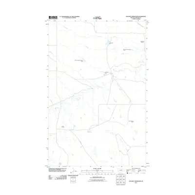
2011 Map of Holzhey Reservoir
USGS Topo · Published 2011About this map
Beaver Creek winds through this arid expanse of north-central Montana, where water management is the primary signature of human activity on the land. The landscape is defined by numerous earthen structures designed to capture runoff, including Lonesome Dam, Lone Tree Dam, and the central Holzhey Reservoir. These dams, often bearing local names like Martown Veseth Number 3 Dam and Noel Number 3 Dam, reflect a coordinated effort to sustain ranching and agriculture in Phillips County.
Find a feature on this map
12 named features on this map. Tap any name to fly to it.
Don’t see what you’re looking for? This feature index may not catch every label — zoom into the map to look around manually.
Map Details
Editions of this 2011 Holzhey Reservoir Map
This is the sole edition of this map. No revisions or reprints were ever made.
Other maps of this area

1953 · Havre
USGS Topo · 1:250,000
1954 · Jordan
USGS Topo · 1:250,000

1954 · Glasgow
USGS Topo · 1:250,000

1954 · Lewistown
USGS Topo · 1:250,000
1956 · Jordan
USGS Topo · 1:250,000

1957 · Glasgow
USGS Topo · 1:250,000

1957 · Havre
USGS Topo · 1:250,000

1958 · Glasgow
USGS Topo · 1:250,000
1958 · Jordan
USGS Topo · 1:250,000

1958 · Havre
USGS Topo · 1:250,000