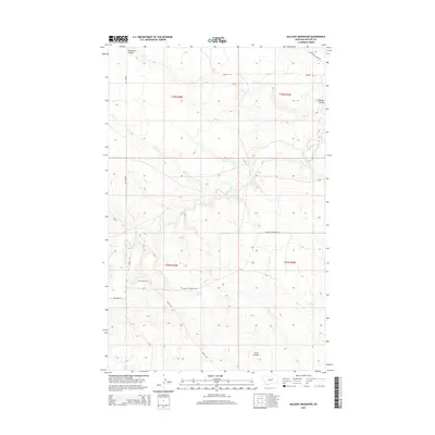
2014 Map of Holzhey Reservoir
USGS Topo · Published 2014About this map
Midale Cem sits as a quiet landmark within this expansive Phillips County landscape, which is defined by its drainages and managed water resources. The terrain is deeply inscribed by Beaver Cr and significant erosional features such as Lonesome Coulee in the north and Scott Coulee to the south. The Holzhey Reservoir serves as a central hydrological point, supporting the agricultural and ranching needs of the region. A network of rural routes, including Midale Rd and Midale Cutacross Rd, connects scattered ranching sections across the township lines of T25N and T26N. Near the southern edge, the presence of Shed Lake further illustrates the reliance on seasonal and permanent water sources in this part of Montana.
Find a feature on this map
15 named features on this map. Tap any name to fly to it.
Don’t see what you’re looking for? This feature index may not catch every label — zoom into the map to look around manually.
Map Details
Editions of this 2014 Holzhey Reservoir Map
This is the sole edition of this map. No revisions or reprints were ever made.
Other maps of this area

1953 · Havre
USGS Topo · 1:250,000
1954 · Jordan
USGS Topo · 1:250,000

1954 · Glasgow
USGS Topo · 1:250,000

1954 · Lewistown
USGS Topo · 1:250,000
1956 · Jordan
USGS Topo · 1:250,000

1957 · Glasgow
USGS Topo · 1:250,000

1957 · Havre
USGS Topo · 1:250,000

1958 · Glasgow
USGS Topo · 1:250,000
1958 · Jordan
USGS Topo · 1:250,000

1958 · Havre
USGS Topo · 1:250,000